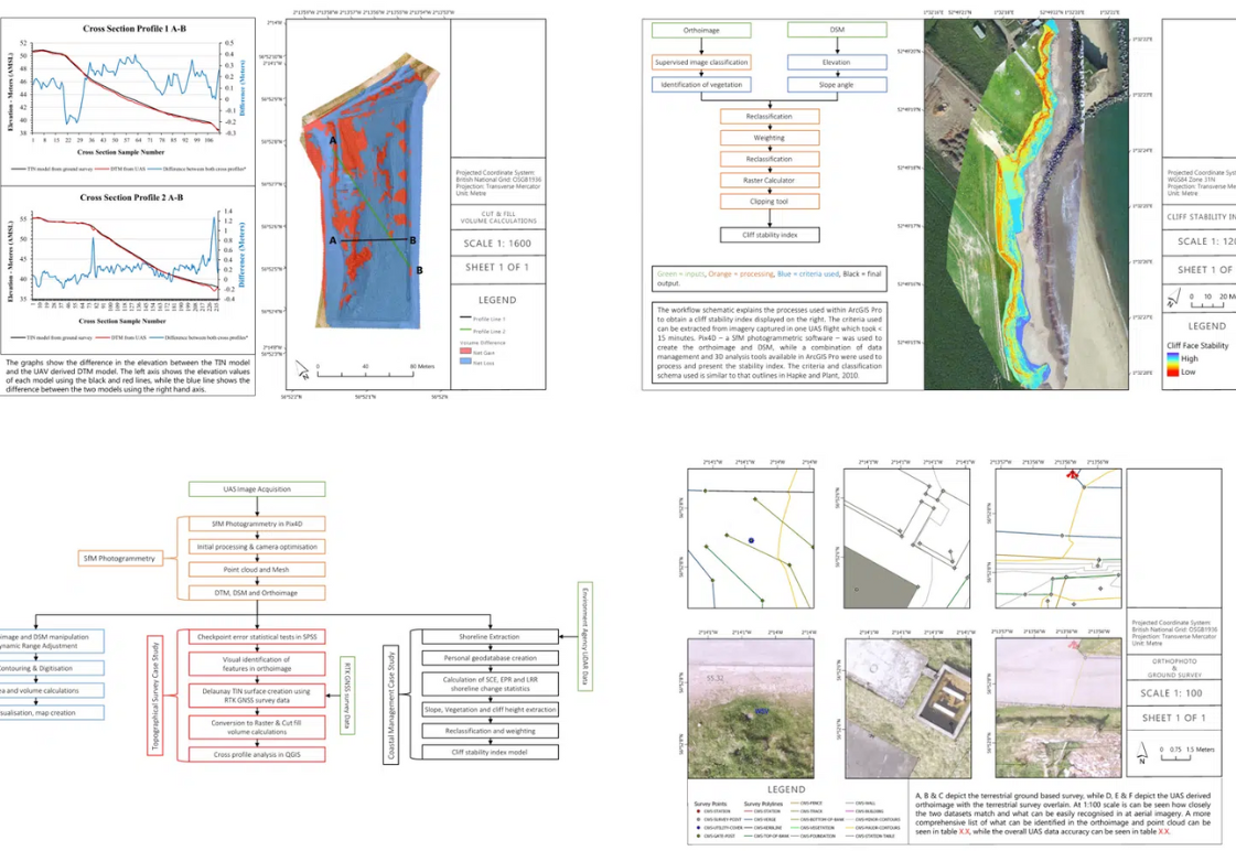
GeoDrone has a proven track record in providing clients with an exceptional level of service. We offer a variety of solutions spanning the data acquisition, processing and analysis sectors.

Why Choose GeoDrone Survey? Why Choose GeoDrone Survey? Why Choose GeoDrone Survey? 

GeoDrone develop and deploy bespoke and highly customisable data processing, analysis and reporting tools, constantly innovating to incorporate the latest GIS solutions.

Working with numerous organisations from large companies to open source development communities, educational groups and scientific bodies, we have an established history of providing our clients with the solutions they need.

We look forward to hearing from you and understanding your project requirements.

Our Services Our Services Our Services

services-data-aquisition

Data Acquisition

Combined with our partners, GeoDrone is able to deploy various high resolution sensors for inspection and survey applications both in the air and on the ground.

Find out more...

services-data-processing

Data Processing

We pride ourselves on our refined and custom processing workflows, which allow us to deliver exactly what is required by our clients, whether it be in 2D or 3D.

Find out more...

Geodronesurvey Hero Image 5

Data Analysis

High quality data is no use without meaningful analysis. We are able to offer various GIS analysis services both in-house and through our partners.

Find out more...

Data Deliverables

Providing Network Operators with state of the art solutions from field to Finish. We can deliver a Network management tool that will transform your approach to consolidated Asset Management

Find out more...

We Are We Are We Are We Are

Certified

Accurate

Personable

Flexible

Our Services

Data Acquisition

Consultancy

GeoDrone provides consultancy services for a variety of applications including entire project management to ground control and airborne flight planning.

With extensive in-house experience designing flight plans for surveys undertaken internationally, we are confident we will be able to advise our clients towards the best data acquisition methods in the air and on the ground.

high quality sensors

Airborne

GeoDrone deploys high-quality sensors and specialist payloads throughout the UK and worldwide.

Whether the deliverable is required for inspection or engineering applications, we will ensure that the sensor deployed is fit for purpose.

Topographical GNSS data collection

Terrestrial

We provide comprehensive ground control services as well as topographical GNSS data collection services. Using RTK, PPK and total stations we are confident of meeting end user requirements.

In addition to our ground control and GNSS data collection services, GeoDrone has extensive experience in large-scale network survey, vegetation encroachment and engineering survey requirements.

Data Processing

Custom Workflows

GeoDrone prides itself on its refined workflows developed over many years to extract the best possible results.

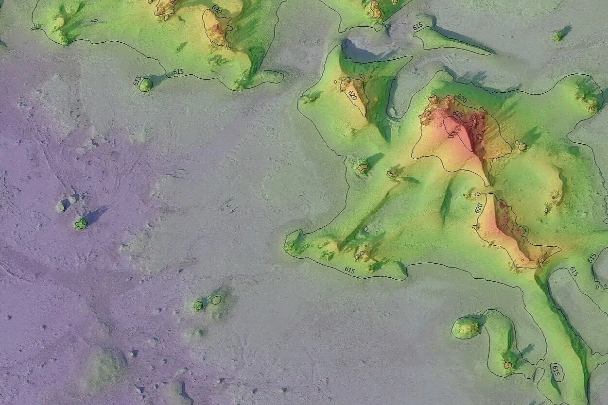
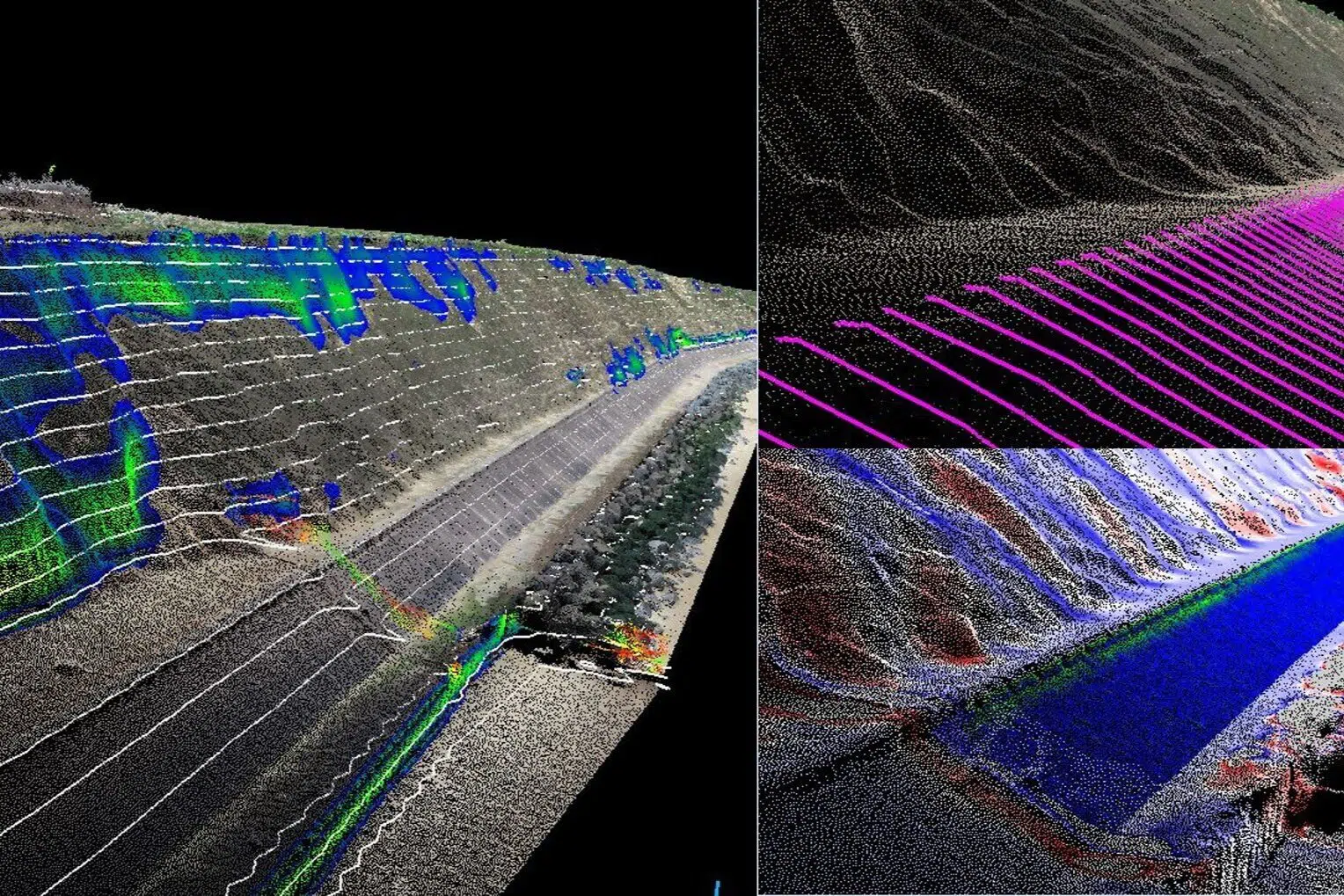
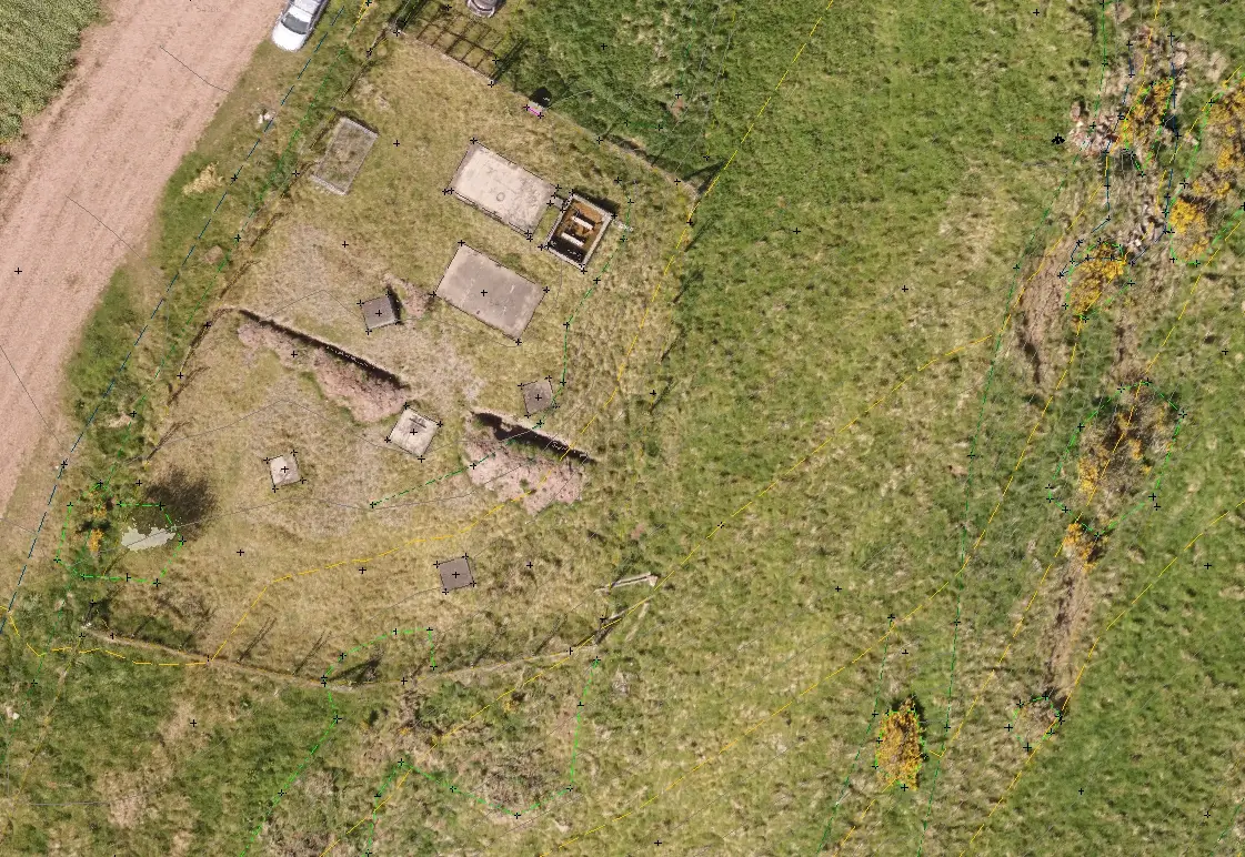
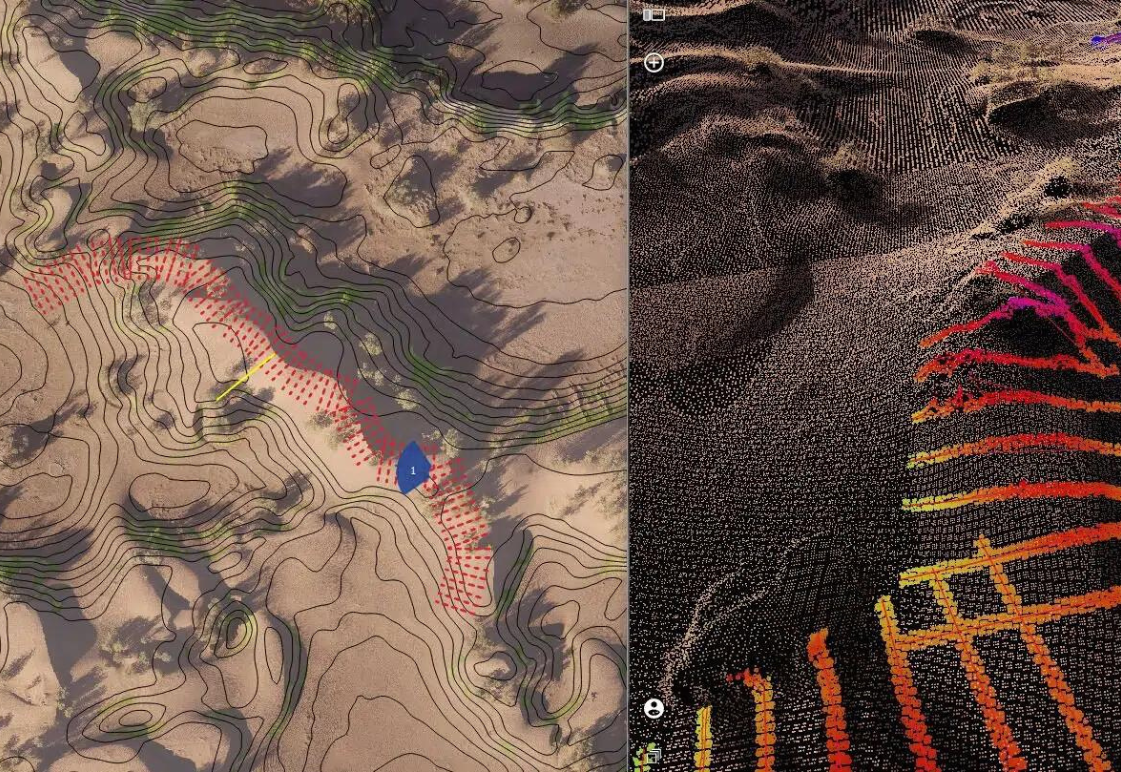
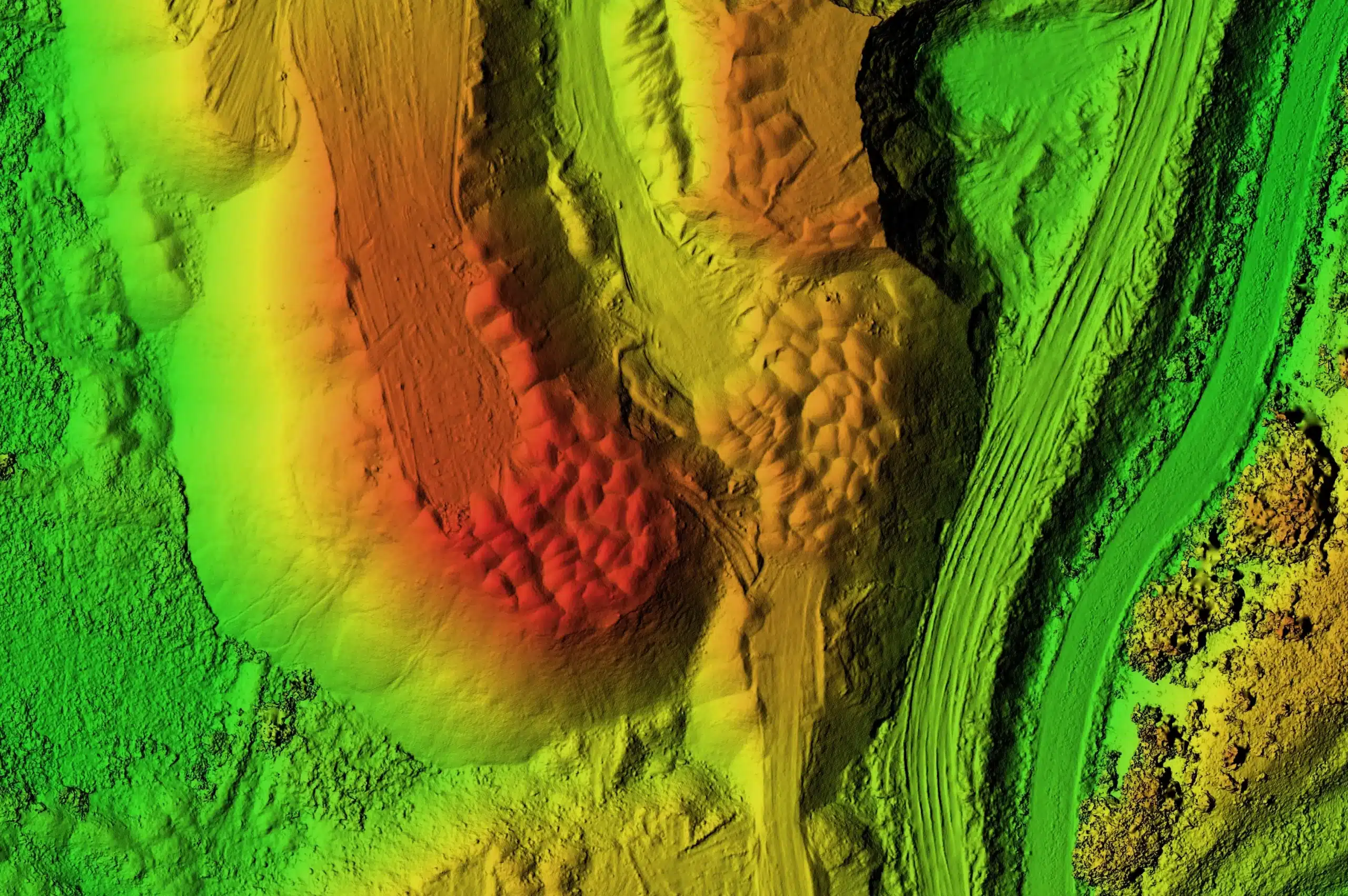
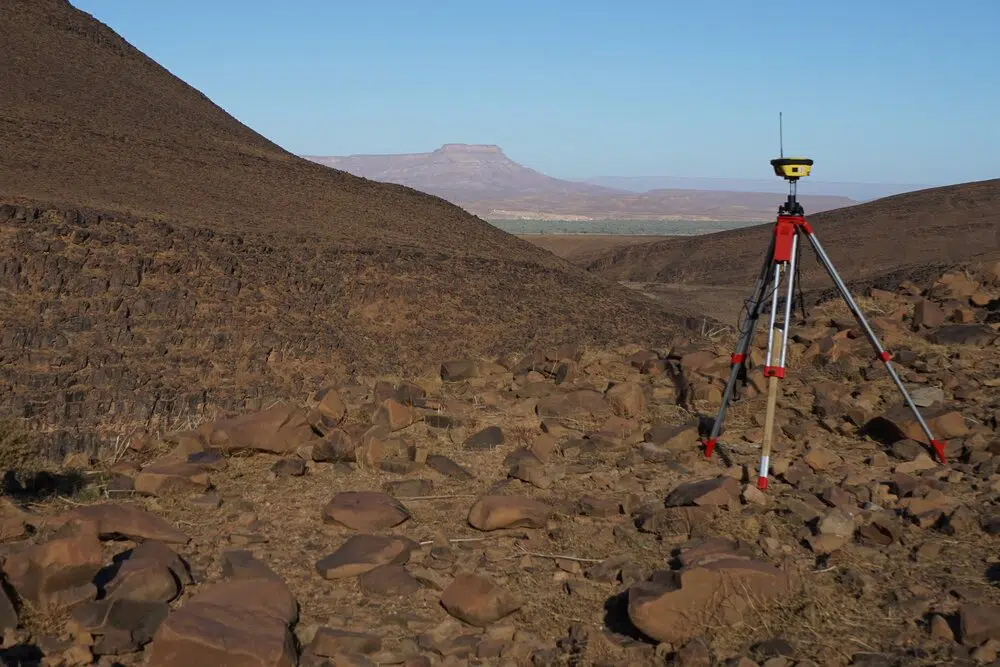
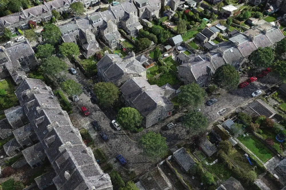
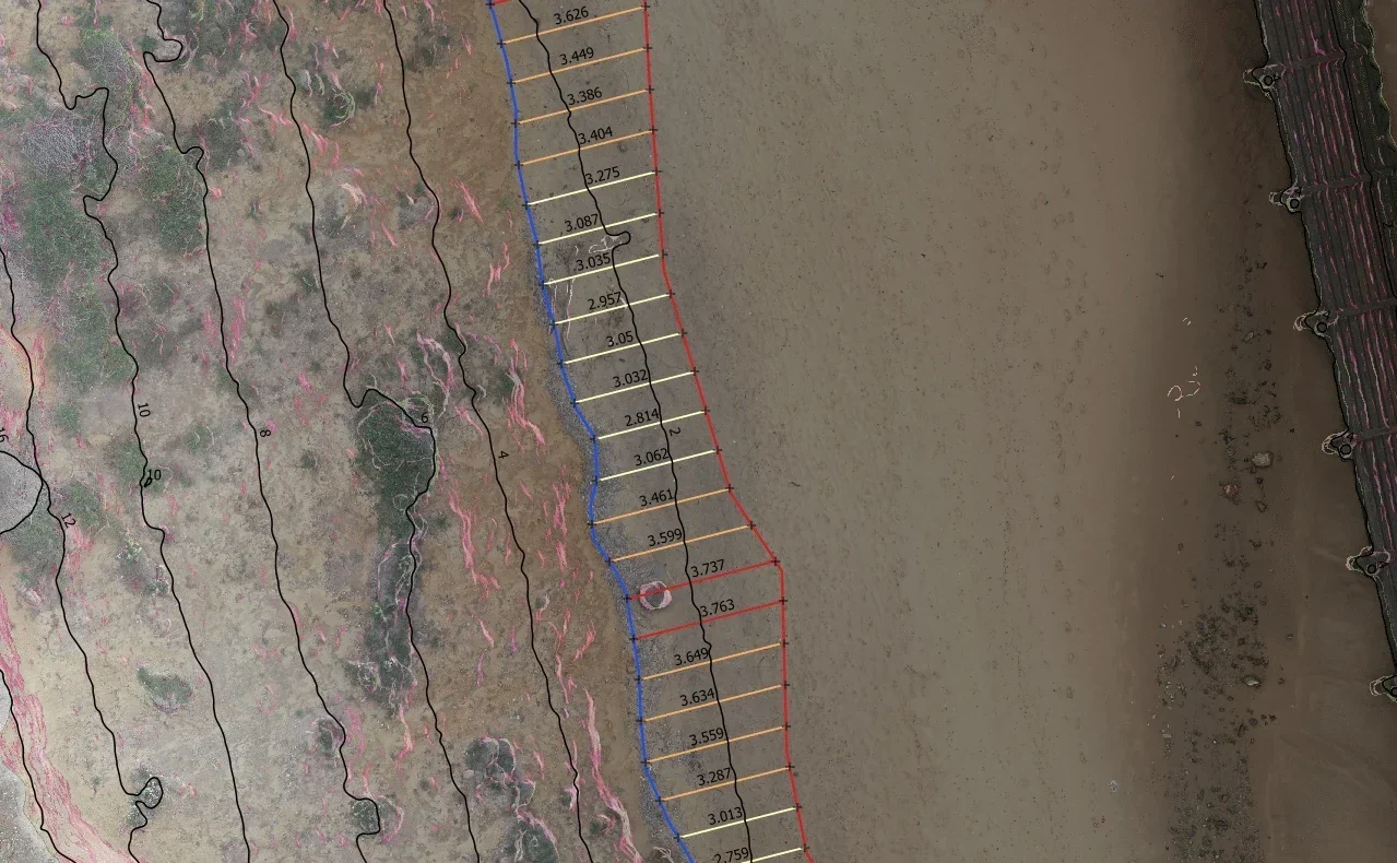
Best in class photogrammetry and LiDAR data processing, with industry recognised accreditations However we also offer other data processing services including camera calibration, coordinate transformations and GIS services.
Geodronesurvey Hero Image 3

Data Processing

Our GIS team is able to process raw data into a variety of GIS and CAD ready products, ranging from orthophotos, digital surface models and point clouds.

Using numerous industry leading software packages, we are able to provide all industry standard formats for digital geospatial products, whether that be a simple point cloud or a complex Geopackage file.

beyond exporting standard datasets from LiDAR and photogrammetry software

Reporting

GeoDrone go beyond exporting standard datasets from LiDAR and photogrammetry software packages. Often clients require a specific piece of information, whether that be visualisations of new buildings, volume calculations or temporal change detection.

Data Analysis

CAD

GIS

GeoDrone can provide various in-house GIS services including Digital Shoreline Analysis, Multi-Criteria Analysis and topographical analysis. Whether you are looking to extract contours or create large scale BIM visualisations we will be able to assist.

Data Delivery Platforms

GeoDrone have a proven track record in providing solutions to industry using our in-house expertise. We provide numerous delivery platforms allowing your data to be integrated into your current workflow.

Complementing traditional delivery methods we also offer web-based data streaming through ArcGIS, QGIS and CAD plugins. Alternatively we can offer a similar service within the Trimble ecosystem. This enables you to keep your current workflow while enhancing your work environment with immersive 3D data, without having to download or install any specialist software.

Data Quality

Ensuring our clients have the data in the formats they need is essential. Our rigorous quality assurance and quality control methods ensure that our survey data are always accompanied by succinct reports which outline our data collection and processing methodologies.

Data Deliverables

The Art of the Digital Twin

Next generation multi-sensor aerial surveys offer Network Operators unrivalled insight into the near real time condition of their Networks.

Critical Infrastructure Management

Aerial imagery has always been an ideal tool for asset management. Recent advances in LiDAR and point cloud analysis bring us into a new era of survey deliverables and management tools to suit every scenario

GeoDrone to GeoTwin

Providing Network Operators with state of the art solutions from field to finish. We deliver Digital twins and Network management tools that will transform your approach to consolidated Asset Management